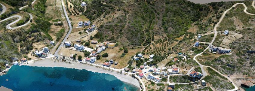
Thanks to modern technological advancements, aerial surveying has become a leading technique in topography and traditional photogrammetry. This method allows us to rapidly acquire vast amounts of geospatial information using images captured by unmanned aerial vehicles (UAVs), such as drones.
3D Digital Models
The speed of image collection, the use of advanced image processing software, and the precision it ensures make aerial surveying ideal for mapping large areas, archaeological sites, quarries, major construction projects, and industrial zones.
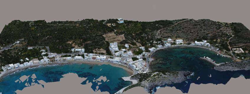
The high quality of digital images is combined with photogrammetry techniques, and aerial photogrammetry is poised to offer significant advancements in the future. The creation of the model and the production of the orthophoto are carried out using photogrammetric methods from aerial photography of the area of interest, complemented by terrestrial methods using GPS.
3D survey
By using the latest in innovative technology, our 3D survey records an incredible amount of data. Highly accurate recordings of the angles and distances between points in the area will reveal complex levels of information that we can then put to use to successfully move your project along to the next phase.
3D Terrain models
We can produce detailed three-dimensional terrain models and objects showing the elevation of natural and artificial features and/or natural and artificial structures.
Orthophotomap production
All of these models and surveys are used either independently, or as a part of the creation of an orthophotmap. The orthophotomap ensures that all the details and elements of the terrain are rendered in the preferred coordinate system. In other words, an orthophotomap is a geometrically correct digital image, without and distortions or discrepancies, and the scale is correct.